


Voting District 0221, Denton County, Texas
About
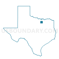
Outline

Summary
| Unique Area Identifier | 672551 |
| Name | Voting District 0221 |
| County | Denton County |
| State | Texas |
| Area (square miles) | 3.95 |
| Land Area (square miles) | 3.91 |
| Water Area (square miles) | 0.04 |
| % of Land Area | 99.00 |
| % of Water Area | 1.00 |
| Latitude of the Internal Point | 33.05733750 |
| Longtitude of the Internal Point | -96.87090960 |
Maps


Graphs
Select a template below for downloading or customizing gragh for Voting District 0221, Denton County, Texas


Neighbors
Neighoring Voting District (by Name) Neighboring Voting District on the Map
- Voting District 0109, Collin County, TX
- Voting District 0131, Denton County, TX
- Voting District 0200, Denton County, TX
- Voting District 0202, Denton County, TX
- Voting District 0203, Denton County, TX
- Voting District 0224, Denton County, TX
- Voting District 0226, Denton County, TX
Top 10 Neighboring County Subdivision (by Population) Neighboring County Subdivision on the Map
- Plano CCD, Collin County, TX (500,724)
- Carrollton CCD, Denton County, TX (112,937)
- The Colony CCD, Denton County, TX (70,088)
Top 10 Neighboring Place (by Population) Neighboring Place on the Map
- Plano city, TX (259,841)
- Carrollton city, TX (119,097)
- Frisco city, TX (116,989)
- Lewisville city, TX (95,290)
- The Colony city, TX (36,328)
- Hebron town, TX (415)
Top 10 Neighboring Unified School District (by Population) Neighboring Unified School District on the Map
- Plano Independent School District, TX (323,965)
- Lewisville Independent School District, TX (267,943)
Top 10 Neighboring State Legislative District Lower Chamber (by Population) Neighboring State Legislative District Lower Chamber on the Map
- State House District 65, TX (224,883)
- State House District 64, TX (219,345)
- State House District 66, TX (160,543)
Top 10 Neighboring State Legislative District Upper Chamber (by Population) Neighboring State Legislative District Upper Chamber on the Map
- State Senate District 12, TX (1,013,641)
- State Senate District 8, TX (940,963)
- State Senate District 9, TX (807,907)
Top 10 Neighboring 111th Congressional District (by Population) Neighboring 111th Congressional District on the Map
- Congressional District 26, TX (915,137)
- Congressional District 3, TX (842,449)
- Congressional District 24, TX (792,319)
Top 10 Neighboring Census Tract (by Population) Neighboring Census Tract on the Map
- Census Tract 215.19, Denton County, TX (12,177)
- Census Tract 216.27, Denton County, TX (6,009)
- Census Tract 216.25, Denton County, TX (3,818)
- Census Tract 218, Denton County, TX (3,796)
- Census Tract 215.18, Denton County, TX (3,085)
- Census Tract 316.56, Collin County, TX (2,535)
- Census Tract 316.45, Collin County, TX (2,162)
- Census Tract 216.26, Denton County, TX (2,091)